Area F · above Bagus Place
Bagus Tower
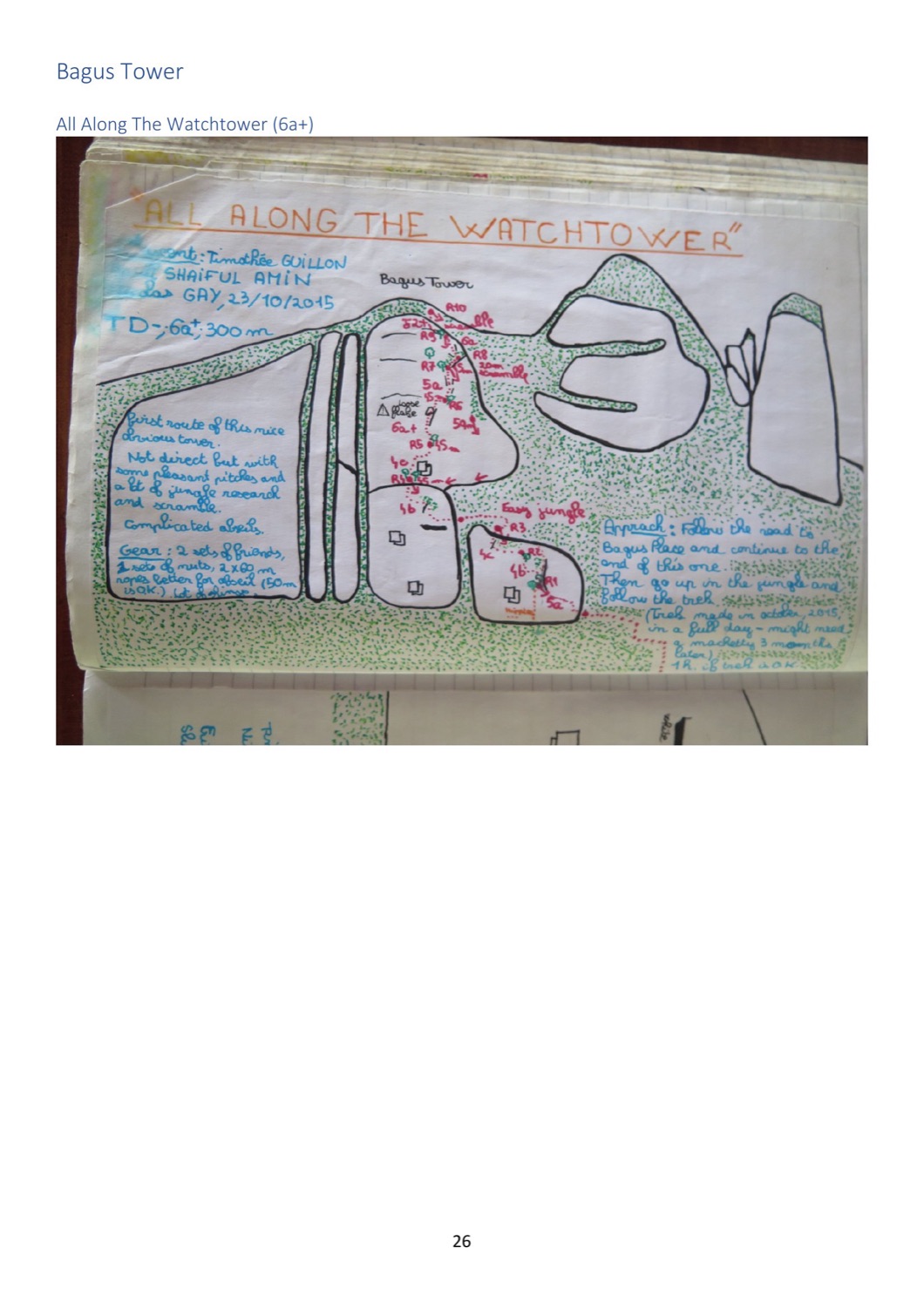
An obvious tower above the end of the Bagus Place road. Both its routes and both its topos come from a single French–Malaysian party in October 2015, and survive only as photographs of a logbook page.
Routes
Ordered as the source records them. Grades keep their original system. Compare across areas in the route finder.
Route Grade Length Pitches First ascent
All Along the Watchtower ★★★ 6a+ 300 m 10 Timothée Guillon, Shaiful Amin, Nicolas Gay 2015 Hippies Tonic ★★ 5a/b 90 m 3 Timothée Guillon & Nicolas Gay
2015